CENTRO BTT ALANÍS

El Centro BTT “Geo Rutas Villa de Alanís”, nace en 2016 con un proyecto subvencionado dentro de la convocatoria realizada por el Servicio Público de Empleo Estatal, Diputación de Sevilla y Excmo. Ayuntamiento de Alanís dentro del programa de Fomento de Empleo Agrario.
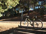
Se trata de un espacio de libre acceso donde tanto debutantes como expertos pueden practicar con tranquilidad la MTB y a la vez conocer las riquezas paisajísticas, naturales y culturales de Alanís. Además, impulsa el uso de la bicicleta en un entorno respetuoso con el medio ambiente y es una manera de proteger y mantener el hábitat de la zona evitando su degradación ambiental.
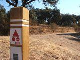
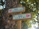
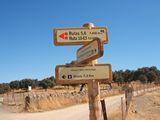
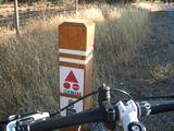
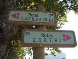
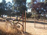
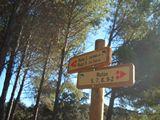
Es un centro de rutas perfectamente señalizadas con 426 km, pensados para todos los niveles, cartografiados y señalizados según el grado de dificultad.
Nuestro objetivo es incrementar la oferta deportiva y de turismo activo de calidad, en nuestro municipio.
Los servicios con los que contamos son:
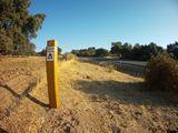
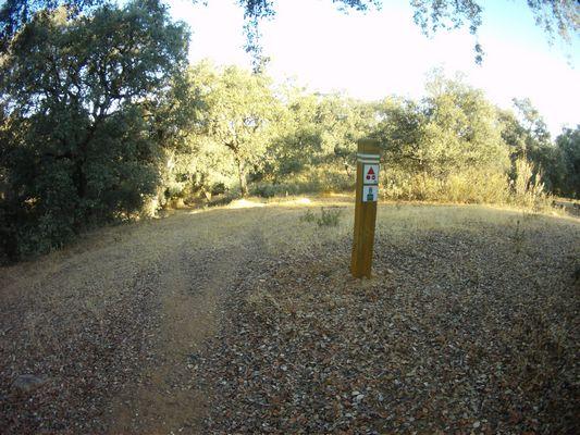
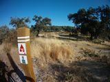
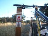
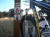
- Señalética interpretativa – orientativa que recoge información sobre las diferentes rutas, usos de circulación, etc.
- Folletos de bolsillos en el que se incluyen las rutas e información.
- Un pequeño taller de reparación.
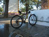
- Un punto de lavado de bicicletas en el punto de recepción.
- Baño y ducha en el punto de recepción.
El ciclista que visite el centro BTT tiene a su disposición, además de todos los servicios anteriores, esta web. La web está diseñada para el ciclista, en ella se pueden descargar, visualizar, etc, toda la información, tracks, mapas, etc.
Igualmente, la web está diseñada para ser completamente accesible desde cualquier dispositivo (ordenador, móvil, tablet). La web se adapta al dispositivo donde se está visualizando.
Cómo seguir las rutas
Seguramente te hayas preguntado cómo seguir un track o una ruta de senderismo con tu móvil o con tu GPS; o por qué necesitas un GPS para ir a la montaña. También aprenderás a grabarlos tú mismo y subirlos a nuestra web.
Un track, como sabrás, es un conjunto de puntos de paso ordenados en el tiempo. Es una sucesión de puntos que va creando el GPS según vamos caminando. Nuestro GPS nos permitirá seguir este track como si cada punto de paso fuera un destino, nos ahorrará mucho tiempo, y además te sentirás mucho más tranquilo con él, podrás ir a cualquier sitio con una buena planificación y sin riesgos.
Para llegar a un lugar, debemos conocer nuestra posición, y saber qué dirección estamos siguiendo.
Según tu nivel de conocimiento de la ruta, puedes usar el GPS solo para determinados cruces en los que te desorientes, o para seguir la ruta completa, con la función de aviso si nos desviamos de la ruta establecida.
Vamos a enseñarte a hacerlo con Orux Maps, una aplicación GPS offline, pero hay otros muchas. Al ser offline permite usar mapas y geolocalización, solo con el GPS y sin usar Internet. Lo puedes descargar solo en Android.
Tiene un gran número de funciones, pero vamos a explicar su funcionamiento básico.
Composición:
Tiene una barra superior con 4 iconos, más otro desplegable. Debajo de los iconos está el “Estado” (nos indicará si estamos grabando el track, si está el GPS funcionando, si hay alarmas activas). El mapa está en el centro (ocupando la mayor parte de la pantalla), en la parte de la derecha y de la izquierda hay 2 pequeños menús desplegables, y en la parte inferior tenemos la información del GPS.
¿Qué significa cada icono?

Flecha: opciones para generación y uso de tracks.

Marcador: acciones con los waypoints y geocachés.

Carretera: gestión de tracks y rutas (nos permite cargar y descargar rutas, crearlas, …)

Mapa: opciones sobre los mapas

3 puntos: Configuración global, perfiles, gestionar tu cuenta.iconos-laterales-orux-maps
Menú desplegable derecho

Activación/Desactivación de GPS

Activación/Desactivación de Track

La mano (fija la pantalla, no sigue al GPS)

Menú de utilidades

Mapa 3D
¿Cómo creamos un mapa offline?
- Es importante tener mapas offline para cuando te encuentres en la montaña y estés sin conexión, puedas orientarte bien. Vamos a enseñarte a tener un mapa offline de Las Merindades, y te recomendamos que tengas mapas offline de las zonas a donde vayas a hacer senderismo.
- Haz clic en el icono “mapa” (el cuarto), después “abrir mapa” (aquí veremos mapas Online y mapas offline que hemos ido añadiendo). Seleccionamos Online / capas/World/(ES) y Mapa Raster IGN (ES). Creemos que es un mapa muy completo. Buscamos la zona en concreto que queremos tener offline.
- Una vez que veamos la zona que queremos tener, le volvemos a dar al icono del “mapa”, y le damos a “creador de mapa”.
- En el mapa, ponemos 2 puntos, uno en cada esquina inversa del mapa (superior izquierda e inferior derecha o al revés). Nos saldrá un rectángulo, lo verificamos dándole al botón azul de OK.
- Ahora tenemos que guardar las capas, cuantas más tickes, mejor. (más profundidad tendrá nuestro mapa). También tenemos que poner un nombre al mapa, le damos a descargar, y ya tenemos el mapa offline creado.
- Para usar dicho mapa, le damos a “mapa“, a “abrir mapa“, offline, y abrimos el mapa con el nombre que hemos puesto, y lo tendremos activo de manera offline.
Generar un track
Le damos al icono de la flecha, y a iniciar grabación. Con esto grabaremos nuestra ruta, o podemos continuar una ya iniciada. Es muy muy fácil. Podemos añadir más cosas según pasemos por la ruta, como waypoints, dándole al segundo icono (el del marcador) y le damos a crear , e incluso lo podemos marca con una imagen.
Cargar y seguir un tracks
- Si lo hemos descargado: Por ejemplo, en cada ruta, puedes descargarlos fácilmente en esta misma web (lo vemos en la imagen aledaña). Le damos al tercer icono (el de la carretera) y a cargar KML/GPX (por si no lo sabes, son los formatos más importantes en los que se guardan los tracks). Lo cargamos desde donde esté previamente guardado. Recomendamos guardarlos siempre en la misma carpeta, para no volvernos locos. Al abrirla, tenemos opciones de navegación, como invertir la ruta, o que nos avise, con alarmas como la alarma de ruta o alarma de waypoint; o solo verla en el mapa (entonces elegiremos no navegación).
- Si lo hemos grabado nosotros anteriormente: Le damos al tercer icono (el de la carretera) y a “gestionar tracks/rutas“, donde tenemos guardadas nuestras rutas, seleccionamos la que queremos y elegimos lo que queremos hacer con ella (lo normal es que lo carguemos como ruta en el mapa)
Cuando tengamos datos antiguos en la pantalla, lo que tenemos que hacer es “limpiar pantalla“.
Herramientas
- Orux Maps tiene muchísimas herramientas, vamos a enseñaros 2 de las más utilizadas. En el menú de la derecha, al hacer clic en el icono que es como un círculo o una brújula hay infinidad de datos estadísticos de la ruta, giroscopio, y brújula. Debajo de él hay otro icono como un cubo, en el que podemos ver el mapa en 3D.
Ya sabéis cómo seguir rutas, es muy importante cuándo vayáis a la montaña que os descarguéis la ruta para minimizar las posibilidades de perderos.
Normas de uso
Recorrer el Centro BTT de Alanís, consiste en disfrutar de rutas auto guiadas, es decir, carecen de señalización, por lo que deberemos conseguir el mapa y los rutómetros o los tracks de GPS para no perdernos.
Cada uno puede ir al ritmo que prefiera, parando y disfrutando de las rutas que recorren algunos de los más singulares y recónditos lugares de del Parque Natural Sierra Norte de Sevilla.
Cada ciclista es responsable de sus actos y decisiones, así como del mantenimiento y conservación de su bicicleta durante los recorridos. Cada ciclista es libre de participar y lo hace por propia iniciativa, sabiendo que las rutas están catalogadas con diferentes niveles, desde fácil a muy difícil y que para la realización de las mismas se requiere forma física y dominio de la bicicleta adecuados al nivel de exigencia de la ruta y lo hace bajo su total responsabilidad e independencia.
Cuando se transite por carreteras nos ceñiremos siempre al código de circulación vial que debe ser nuestro referente. Una de las mayores demandas de los ciclistas en general es la falta de seguridad en las carreteras, si pretendemos que la misma sea alta en ellas y el respeto a los ciclistas sea el debido, tendremos que ser los primeros en respetar estas normas de convivencia entre todos los usuarios.
Cuando realices los recorridos deberás ajustarlo a tus posibilidades tanto físicas como técnicas, si acometes un recorrido muy por encima de ellas el mismo puede convertirse en un calvario donde apenas podrás disfrutar. Dosifica tus fuerzas y adecua tu velocidad de acuerdo al estado del terreno, no debemos pretender circular a igual velocidad en una ancha y uniforme pista que en un estrecho, sinuoso e irregular sendero. Otro de los secretos del ciclismo de montaña es el ritmo al que se practica. Procura dejar tiempo para recrearte en la observación de la flora, fauna, paisajes y costumbres del lugar por el que transitas, serán la esencia del mismo.
Deberás llevar un equipo mínimo que te sacará de multitud de inconvenientes que a buen seguro surgirán durante tus trayectos con la bicicleta. El mismo debe estar compuesto por cámara de repuesto para un eventual pinchazo (atención al tipo de válvula de la rueda), material de reparación para la misma (puede sobrevenir más de un pinchazo), bomba de inflado eficiente y una multi herramientas que cubra las necesidades básicas (debe incluir troncha cadenas). También deberemos llevar ropa adecuada a las condiciones climáticas del día.
Nuestra “gasolina” al ir a pedales será la comida y bebida, por lo tanto, esta no nos debe faltar en ningún momento. Debes ir bien avituallado.
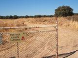
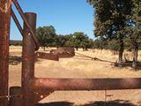
Cuando transites sé respetuoso con el medio, la flora y fauna del lugar, así como con las propiedades por donde pasemos y los lugareños.
Cuando circulemos por el medio rural, nos ceñiremos a las pistas, caminos y senderos permitidos, el pedalear fuera de ellos acarreará una importante erosión del terreno.
No abandones nunca tus desperdicios, ni incluso los orgánicos como las mondas de la fruta, la contaminación visual es tremenda, seguro que en tu discurrir no tardarás en encontrar un lugar adecuado donde deshacerte de ellos.
Independientemente de ser obligatorio en carretera, el casco irá siempre correctamente colocado. Hoy en día son tan cómodos y livianos que apenas si lo notaremos y se convertirá en nuestro “seguro de vida”.
Todos los usuarios del Centro BTT de Alanís están obligados a cumplir las normas de uso del Parque Natural Sierra Norte de Sevilla.
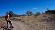
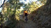
Rutas del Centro
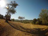
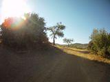
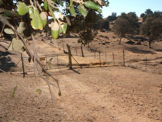
El centro BTT de Alanís está caracterizado por su emplazamiento, en pleno Parque Natural Sierra Norte de Sevilla y el medio natural que le rodea, aportando a las distintas rutas una asombrosa variedad de terrenos que difícilmente encontraremos en otros lugares. Pudiendo en una misma ruta alcanzar cimas de montañas por encima de los 800 metros de altitud y poco rato después encontrarnos en las orillas de la Playa Verde de San Nicolás del Puerto. Atravesando en ese trayecto un frondoso bosque, quizás inimaginable para muchos en estas sierras.
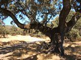
Los grandes bosques de alcornoques y especies de la dehesa andaluza y paisajísticos del centro. Todos los recorridos aparecen vinculados de una u otra forma a los dos espacios naturales protegidos que recorren.
Los valiosos recursos naturales del Parque Natural Sierra Norte, declarado como Geoparque, han atraído desde antaño a numerosas civilizaciones. El paisaje ha sido transformado por los diferentes pobladores quienes aprovecharon la riqueza que el espacio les brindaba. Un ejemplo de este cambio es el Cerro del Hierro, declarado Monumento Natural, donde la extracción de mineral y la acción de la lluvia han dejado al descubierto un paisaje kárstico que hoy día es aprovechado por deportistas para la práctica de la escalada.
Sierras de lomas suaves, donde predominan las zonas adehesadas de encinas y alcornoque, entremezcladas con bosque mediterráneo y algunos cultivos de olivo y vid. En algunas zonas umbrías y húmedas de los municipios de Constantina y Cazalla, junto a los únicos robles melojos de la provincia, se dan además, castañares para el aprovechamiento de sus varas. Junto al centro de visitantes El Robledo se encuentra el jardín botánico del mismo nombre, donde se recoge una colección de las especies vegetales más características de Sierra Morena.
La red hidrográfica del parque natural también juega un papel fundamental en su historia y paisaje. Tres son los ríos principales que refrescan la comarca: el Rivera del Huéznar, en la zona central del parque, el río Viar al Oeste y, por último, el Retortillo, al Este. Los dos primeros acogen magníficos bosques galerías, donde realizar la pesca de la trucha, una modalidad insólita en Sevilla.
Quienes opten por el senderismo y el cicloturismo se le aconseja el recorrido de la Vía Verde de la Sierra Norte, un antiguo trazado ferroviario minero que discurre entre el antiguo poblado de Cerro del Hierro y la estación de tren Los Prados-Cazalla, pasando por el Monumento Natural Cascadas del Huéznar. El baño está prohibido en las cascadas. La denominada playa de San Nicolás, aguas arriba del monumento natural, es el único lugar habilitado para ello.
Águilas imperiales ibéricas, reales y perdiceras surcan el cielo del parque natural. También son habituales aves carroñeras como el buitre negro y el leonado. Entre los mamíferos ungulados, como el ciervo y el jabalí, son habituales. El monte público de las Navas-Berrocal, en Almadén de la Plata te permitirá observarlas de una forma sencilla.
Contribuyen a su patrimonio cultural, los diez municipios que forman parte del parque, aportando interesantes monumentos histórico-artísticos como castillos árabes, iglesias y ermitas de tradición cristiana. Vestigios de un pasado más lejano se hallan en Almadén de la Plata, donde se han encontrado restos prehistóricos.
Características genéricas de las rutas del centro
El entramado de rutas se encuentra constituido por 10 itinerarios que se reparten uniformemente por el espacio que ocupa el centro. Alcanzan una distancia de 418,89 kilómetros de longitud y acumulan un desnivel positivo de 9344 metros. La mayor altitud es de 1847 metros y la menor de 93 metros, con lo que la diferencia absoluta de desnivel es de 9251 metros y el mayor que encontraremos dentro de una de las rutas es esta misma, al alcanzar ambos puntos, concretamente la nº 10, tramo 1.
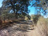
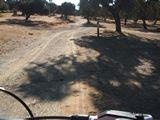
En cuanto al terreno por el que discurren estas, solo en un 10% lo hacen por asfalto, siendo el restante en un 20% por pistas y en un 60% por senderos. Aún contando con un porcentaje elevado de senderos, la mayoría de ellos son bastante asequibles. En cualquier caso, los niveles de las rutas son asequibles para la gran mayoría de usuarios, ya que muchas discurren por pistas de cómodo piso.
La distribución de las rutas se equilibra desde los dos puntos de inicio, partiendo desde cada uno de ellos. Con un total de una ruta fácil, dividida en dos tramos, tres rutas de complejidad media, y el resto de complejidad difícil, el centro BTT de Alanís es el referente en la Sierra Morena de Sevilla.
Muchas de las rutas son combinables entre sí dando la posibilidad de configurar a gusto del usuario otros recorridos de diferentes longitudes, dificultades y desniveles, en la documentación de cada una de las rutas se reflejan las conexiones recomendadas.
NIVEL DE DIFICULTAD
Fácil
Accesible a cualquier persona con un mínimo de destreza en la bici y con una preparación física básica. Pistas, caminos y algún trozo de sendero sin ninguna dificultad especial. Recorridos con muy poco desnivel, aunque puede haber surcos, regueros, baches importantes e incluso boquetes. No existen pendientes pronunciadas. Itinerarios bastante fáciles de seguir.
Media
Ciclistas habituados/as a salir en bici. Pequeños puertos con desniveles moderados (10%), tramos de sendero más largos que pueden obligar a desmontar a los/as ciclistas de menor nivel técnico. Algunos tramos de camino muy pedregosos.
Difícil
Para buenos/as ciclistas de montaña. Puertos largos (>10 km) y/o duros (>10%). Senderos técnicos y difíciles. Importantes descensos donde extremar las precauciones. Posible porteo.
Muy Difícil
Solo expertos ciclistas de montaña. Desniveles duros y continuados. Alta dosis técnica. Largos tramos de senderos y caminos muy pedregosos. Algún tramo expuesto. Algún tramo donde agudizar la orientación. Tramos de porteo.
Ruta 1: Loma de San Miguel
Ficha técnica
- Distancia: 30,81 km.
- Altura máxima: 714 m.
- Desnivel acumulado (+): 692 m.
- Desnivel acumulado (-): 692 m.
- Accesibilidad: En bicicleta y a pie.
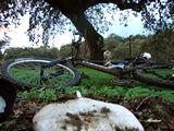
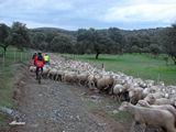
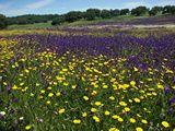
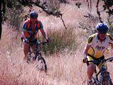
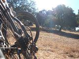
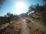
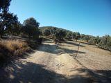
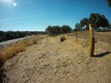
IMÁGENES DE LA RUTA
INFORMACIÓN SOBRE LA RUTA
Partimos desde la Alameda del Parral, por carretera local asfaltada hasta el área recreativa de San Pedro. Desde aquí vamos por caminos hasta la denominada finca “La Nava” y tomamos rumbo norte hasta cruzar la carretera A447. Tomamos caminos que cruzan las dehesas de los “Barrancos y la Encarnación” para salir por la finca “Los Morenos” hacia la carretera SE167, tomando dirección oeste por un tramo asfaltado en el que habrá que circular con precaución.
Ruta 2: Cañada Real de las merinas
Ficha técnica
- Distancia: 46,83 km.
- Altura máxima: 806 m.
- Desnivel acumulado (+): 1192 m.
- Desnivel acumulado (-): 1192 m.
- Accesibilidad: En bicicleta y a pie.
IMÁGENES DE LA RUTA
INFORMACIÓN SOBRE LA RUTA
Salida desde Alanís hacia finca “La Higuera” por un alcornocal de gran belleza y continuamos por la dehesa de “El Senadal” próximos a la carretera SE167 donde tomamos rumbo norte hacia la finca “La Urbana”, desde donde cruzamos la carretera y tomamos dirección a Guadalcanal entre encinas y Olivos.
Cruzamos Guadalcanal y nos dirigimos hacia la finca “Hamapega”, zona primera de olivar y luego de coscojas y monte bajo, paralelos a la vía ferroviaria Sevilla-Mérida.
Nos separamos de la vía férrea y volvemos por caminos entre encinas hasta llegar a la senda, pista forestal que continuamos nuevamente paralela a la vía. Cruzamos un paso a nivel y volvemos hacia Alanís por caminos entre dehesas pasando por dos antiguos molinos de agua.
Ruta 3: Los aguardianteros
Ficha técnica
- Distancia: 23,46 km.
- Altura máxima: 706 m.
- Desnivel acumulado (+): 566 m.
- Desnivel acumulado (-): 566 m.
- Accesibilidad: En bicicleta y a pie.
IMÁGENES DE LA RUTA
INFORMACIÓN SOBRE LA RUTA
Salimos desde la Alameda del Parral, atravesando el casco urbano por la calle Hierro, pasando por finca “Los Tejares” entre olivos y encinas y tomando direción hacia “Los Zarzares” por el arroyo de “Las Mesas”, zona de especial interés por lo sinuoso del recorrido y la gran variedad de fauna y flora.
Posteriormente llegamos a la vía denominada “La Senda” y siguiendo el límite entre Alanís y Cazalla de la Sierra pasamos el antiguo apeadero de “La Esperanza” y cruzamos la vía férrea Sevilla-Mérida subiendo por la finca “El Título” por un camino, dejando a nuestra derecha un profundo cañón.
Seguimos hasta el cruce con la carretera Alanís-Cazalla y continuamos hacia los molinos de agua de la ribera de Benalija, pasando por la alameda y fuente de “Panfalto”, llegaremos a la antigua carretera Alanís-Guadalcanal donde tomaremos a la derecha hasta llegar de nuevo al casco urbano de Alanís.
Ruta 4: Circular a Guaditoca
Ficha técnica
- Distancia: 34,73 km.
- Altura máxima: 772 m.
- Desnivel acumulado (+): 773 m.
- Desnivel acumulado (-): 773 m.
- Accesibilidad: En bicicleta y a pie.
IMÁGENES DE LA RUTA
INFORMACIÓN SOBRE LA RUTA
Partimos desde la Alameda del Parral y tomanando la dirección hacia la finca “La Higuera” por un camino de espectaculares alcornoques, para después continuar por una zona conocida como “El Senadal” y dirección al cortijo “La Urbana” desde donde cruzamos la carretera SE167, dirección finca “El Coto” pasamos por encinares y monte bajo, divisándose desde la distancia una zona llana la Ermita de Ntra. Sra. de Guaditoca, patrona de Guadalcanal.
Continuamos nuevamente hasta la finca “La Urbana” tomando el mismo camino hacia el casco urbano en sentido contrario.
Ruta 5: Alanís-San Nicolás del Puerto
Ficha técnica
- Distancia: 28,70 km.
- Altura máxima: 712 m.
- Desnivel acumulado (+): 380 m.
- Desnivel acumulado (-): 380 m.
- Accesibilidad: En bicicleta y a pie.
IMÁGENES DE LA RUTA
INFORMACIÓN SOBRE LA RUTA
Salimos desde la Alameda del Parral dirección al área recreativa de “San Pedro” por la carretera local asfaltada.
Del área de “San Pedro” circulamos por caminos entre dehesas de encinares hasta enlazar con la pista forestal, continuando luego por caminos hacia el casco urbano de San Nicolás del Puerto, desde aquí salimos de nuevo por caminos hacia los denominados “Los Coscojales”, entre coscojas, encinas y quejigos, hasta pista forestal, último tramo hasta volver al casco urbano de Alanís.
Ruta 6: Alanís - Vía verde San Nicolás
Ficha técnica
- Distancia: 29,31 km.
- Altura máxima: 703 m.
- Desnivel acumulado (+): 474 m.
- Desnivel acumulado (-): 474 m.
- Accesibilidad: En bicicleta y a pie.
IMÁGENES DE LA RUTA
INFORMACIÓN SOBRE LA RUTA
Comienza en la Alameda del Parral, poco después seguimos por caminos de tierras entre olivos y dehesas. Cabe destacar, el recorrido arroyo abajo por el paraje de “Los Zarzares” y “Las Mesas”, por su dificultdad técnica y gran belleza; poco después llegamos a una vía pecuaria por la denominada Senda, para enlazar con la vía verde hacia San Nicolás del Puerto.
Continuamos hacia la zona denominada “Los Coscojales” entre coscojas, encinas y quejigos, para terminar con un último tramo de pista forestal hacia el casco urbano de Alanís.
Ruta 7: Alanís - Cerro del Hierro - San Nicolás
Ficha técnica
- Distancia: 40,78 km.
- Altura máxima: 737 m.
- Desnivel acumulado (+): 520 m.
- Desnivel acumulado (-): 520 m.
- Accesibilidad: En bicicleta y a pie.
IMÁGENES DE LA RUTA
INFORMACIÓN SOBRE LA RUTA
Salimos desde la Alameda del Parral, por un corto tramo de carretera hacia pista forestal para luego entrar por caminos de dehesas hasta enlazar con carretera SE168, paralela a la ribera del Hueznar, hasta llegar al casco urbano de San Nicolás del Puerto.
Desde aquí tomamos rumbo al Cerro del Hierro por la antigua vía del ferrocarril, hoy convertida en vía verde. Ya en el poblado del Cerro, pasamos por parte de la antigua mina de hierro a cielo abierto, para luego volver por caminos rodeados de encinas y alcornoques, pasando por un tramo de robles centenarios.
Volvemos por caminos entre dehesas y tramo de pista forestal hasta llegar nuevamente a Alanís.
Ruta 8: Alanís - Los Coscojales
Ficha técnica
- Distancia: 17,25 km.
- Altura máxima: 710 m.
- Desnivel acumulado (+): 187 m.
- Desnivel acumulado (-): 187 m.
- Accesibilidad: En bicicleta y a pie.
IMÁGENES DE LA RUTA
INFORMACIÓN SOBRE LA RUTA
Comenzamos desde la Alameda del Parral con un corto tramo urbano y de carretera hasta entrar en una posta forestal, circulando entre olivares para luego pasar a caminos entre encinas y monte bajo.
La vuelta la haremos hacia el casco urbano por veredas que circulan entre coscojas, encinas y quejigos.
Ruta 9: Iniciación 1º
Ficha técnica
- Distancia: 6,69 km.
- Altura máxima: 688 m.
- Desnivel acumulado (+): 93 m.
- Desnivel acumulado (-): 93 m.
IMÁGENES DE LA RUTA
INFORMACIÓN SOBRE LA RUTA
Salida de la Alameda del Parral pasando por un pequeño tramo de casco urbano, por donde nos adentramos por un camino vecinal, donde comenzaremos a visualizar el prado de “La Servilleta”, para llegar a los restos de antiguos molinos de agua, pudiendo divisar en esa misma zona, lo que conocemos como “La Cueva”.
Continuando paralelo a la ribera de Benalijar, llegaremos también a la fuente de “Panfalto”. Continuaremos por camino vecinal hasta llegar al casco urbano.
Ruta 9: Iniciación 2º
Ficha técnica
- Distancia: 14,68 km.
- Altura máxima: 688 m.
- Desnivel acumulado (+): 180 m.
- Desnivel acumulado (-): 180 m.
IMÁGENES DE LA RUTA
INFORMACIÓN SOBRE LA RUTA
Salimos desde la Alameda del Parrla por carretera local hacia el área recreativa de San Pedro, donde iremos viendo pequeñaas parcelas detinadas al pastoreo de ganado.
Continuaremos hacia la pista forestal en forma circular hacia Alanís, entre parajes de olivos, alcornoques y encinas, hasta llegar al casco urbano de Alanís.
Ruta 10: Comarcal Norte, Tramo 1
Ficha técnica
- Distancia: 48,6 km.
- Altura máxima: 796 m.
- Desnivel acumulado (+): 1847 m.
- Desnivel acumulado (-): 1879 m.
IMÁGENES DE LA RUTA
INFORMACIÓN SOBRE LA RUTA
Partimos del casco urbano por carretera local hacia área de San Pedro. Los primeros metros desviándonos hacia la finca “La Higuera”, cruzando la carretera A447. Continuamos por la dehesa “El Senadal” hasta la carretera SE167 y tomamos hacia el sur por la Cañada Real de las Merinas hasta interceptar la carretera A432 cruzándola y tomando dirección a la zona denominada “Valdebenito”, todo el tramo transcurre entre dehesas de encinas y monte bajo.
Llegando a “Valdebenito” vamos hacia el sur por camino de los Aguardianteros, zona especialmente bella por la frondosidad y diversidad de vegetación, bajando paralelos al cauce de un arroyo.
Ruta 10: Comarcal Norte, Tramo 2
Ficha técnica
- Distancia: 49,2 km.
- Altura máxima: 796 km.
- Desnivel acumulado (+): 1402 m.
- Desnivel acumulado (-): 1526 m.
IMÁGENES DE LA RUTA
INFORMACIÓN SOBRE LA RUTA
Seguimos por la derecha en dirección noroeste por caminos conocidos como “La Senda” entre los términos municipales de Alanís y Cazalla de la Sierra, cruzamos nuevamente la A432 y vamos dirección norte hacia la finca “Hamapega” por donde pasaremos entre encinas y al norte por vegetación de monte bajo, retamas, coscojas, etc.
Continuamos paralelos a la línea férrea Sevilla-Mérica, poco después, llegamos al casco urbano de Guadalcanal.
Desde Guadalcanal y por fincas dedicadas al olivar giramos hacia el noroeste hasta la finca “La Urbana” para seguir por carretera SE167 hacia la finca “El Coto” y dirección a la Ermita de Nuetra Señora de Guaditoca, Patrona de Guadalcanal, tramo este donde igualmente disfrutamos de paisajes entre encinas y monte bajo.
Ruta 10: Comarcal Norte, Tramo 3
Ficha técnica
- Distancia: 55,2 km.
- Altura máxima: 796 km.
- Desnivel acumulado (+): 1164 m.
- Desnivel acumulado (-): 1051 m.
IMÁGENES DE LA RUTA
INFORMACIÓN SOBRE LA RUTA
Desde la ermita circulamos por pista forestal cercanos al casco urbano de Malcocinado y en dirección finca “Las Morenas” atravesando esta y dirigiéndonos hacia el este hasta cruzar la carretera A447 donde tomamos dirección sur por senderos de cierta técnica buscando la zona denominada “El Encinar” por donde vamos dirección este hasta pista forestal que cruzamos y tomamos por camino hacia el casco urbano de San Nicolás del Puerto, lugar donde podemos visitar la ribera del Hueznar y su antiguo puente sobre el arroyo de Galindón.
Desde San Nicolás tomamos por una ruta con gran diversidad de vegetación por zona conicida como “Los Coscojales” hasta enlazar con pista forestal que continuaremos hacia el este hasta la zona llamada de “San Ambrosio”, zona que ya conocemos por haber pasado con anterioridad. Desde aquí iremos hacia el sur pasando por varios paisajes hasta el antiguo poblado minero de “El Cerro del Hierro” donde podremos visitar y disfrutar de un paisaje muy característico de las minas a cielo abierto.
Desde El Cerro del Hierro y por la vía verde, antigua vía férrea por donde se transportaba el mineral del hierro de las minas, llegamos de nuevo al casco urbano de San Nicolás. Continuamos por la vía verde hasta un punto llamado “Cuatro Mojones” que divide y se unen los términos de Alanís, San Nicolás, Cazalla de la Sierra y Constantina. Hacemos un pequeño tramo de carretera y por la senda buscamos nuevamente el camino de los Aguardianteros hacia el norte por la finca “Valdebenito” y hasta la llegada a Alanís.