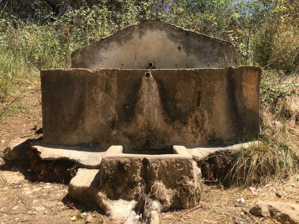
Fontaine de santé (les becs).
“du Pilarejo
de la Cueva_ ” de Panfalto (Chaparrillo)_ ” de la Cueva_ ” de Panfalto (Chaparrillo)_ ” de la Sartén_ ” de la Sartén.
de Panfalto (Chaparrillo)_ ” de la Sartén_ ” de la Sartén.
” de la Sartén.
We start from the Paseo de la Alameda del Parral towards the carril de las Navas but seeing that for 2 km, the path did not change much, we decide to retrace our steps and continue, as we reach the Paseo de la Alameda del Parral towards the Calle de la Alegría.
We leave by a path towards the SE-8001 road, observing the factory of Romero Álvarez S.A. and continue for about 300 metres until we reach a path on the left, where we leave various alpechín ponds on the right.
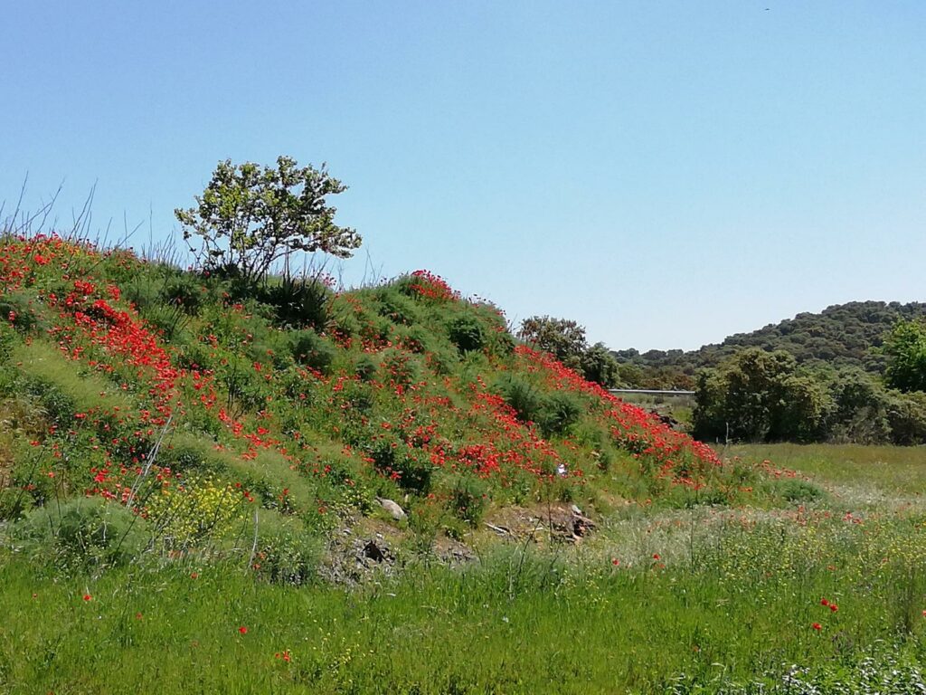
This route, if done in spring, is also known as the route of the flowering rockrose bushes, thousands and thousands of flowering rockrose bushes carpet the landscape. Thousands and thousands of flowering rockrose bushes cover the landscape and the surrounding hills in white. A true marvel that makes the route more bearable and enjoyable.
This route starts in Alanis, in the Parque de la Alameda, and we head south, and through the pastures, passing in front of the Cortijo del Toro, and near the Valdebenito estate, then we head towards the Asperones slope, and then to the Zarzares area, where we soon come across the Arroyo Borbollon, whose course we follow until we arrive near the railway line, where we turn off to the right. We continue in a south-westerly direction until we come to the Arroyo Castillejo, which we ford and then pass in front of the Cortijo de la Quinta, starting our climb towards La Cartuja de Cazalla, passing the Cortijo de El Lagaron, round the back of La Cartuja, and pass the entrance to the Villa Turistica, which is currently closed to the public.
We pass the entrance to the Cartuja enclosure, which we leave on our left, and follow the road towards the Carretera de La Estación. After a short walk along this road, we enter the area of the El Remolino Nature Centre, and following the path, we pass Los Recachos, and arrive at the town of Cazalla de la Sierra.
The frontier of Granada or the Moorish Band and the Santiaguista Priory of San Marcos de León formed and established the ancient Jacobean route of the Camino de la Frontera. In the late medieval period between the two Andalusias there was an element of political and physical separation: the frontier. This formed part of the complicated military and diplomatic scheme established between the Christian kingdoms of Seville and the Nasrid kingdom of Granada, in this sense, there is no reason to think of a permanent warlike situation. Typical institutions of the frontier were the ‘alfaqueques’ and the ‘fieles del rastro’, the former dedicated to the rescue of captives and the latter to the pursuit of outlaws. It seems that both corporations in the late medieval period guarded the roads between fortresses and protected travellers and travellers. At the same time, the military orders of Alcántara, Calatrava and Santiago defended these communication routes and bastions in the present-day mountainous regions of Morón, Osuna and Estepa, respectively.
The Sevillian towns along the Pilgrim’s Way to Santiago de Compostela are linked to the Camino de la Frontera because they belonged to the old Moorish band and because of the close relationship between many of them and Santiago de Compostela, as evidenced by the confluence with the Leonese Priory of Santiago in the Jacobean commendatory of Estepa, where the Camino de la Frontera also became the Pilgrim’s Way to Santiago de Compostela. Apparently, according to chronicles and legends, the apostle St. James the Greater was preaching in Osuna and its surrounding lands before the year 43. The Border Way converges in Olvera (Cádiz) with the Vía Serrana and in Los Santos de Maimona (Badajoz) with the Vía de la Plata”.
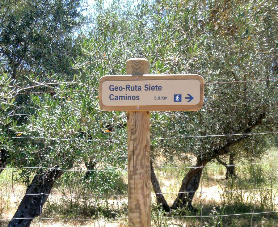
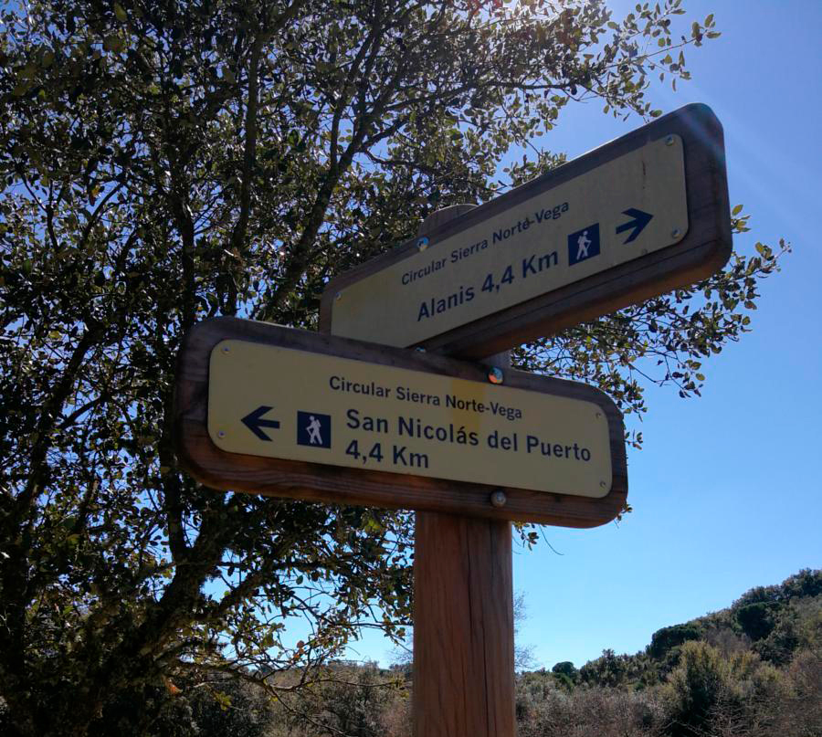
The Siete Caminos Geo-Route starts at the Alameda del Parral, where the tourist office of Alanís is located. Just outside the village, on the left hand side, is the sign for the start of the Geo-Route. Continue along the road to Las Navas and, a couple of hundred metres further on, you will see the milestone sign for Valle del Arroyo del Pueblo.
Further on, a little further on, follow the signpost and turn right. Continue along this path, which later turns to the right and skirts the Valle del Arroyo del Pueblo. Next to a singular building there is a milestone sign indicating that it is a Turruca, a type of building used by shepherds and as a tack room. Continue to the village streets, where you turn left and continue to the San Nicolás road.
When you reach the road, turn right and continue along the cattle track until you reach the crossroads. At this point you have to cross the road, taking extreme precautions, and continue along the path. You will soon see the thematic sign for the Cuenca de Alanís – San Nicolás del Puerto on the left hand side. Continue in the direction of the castle, but before you get there, take the first path on the left. Just past the olive trees there is a place where millstones were extracted, and this is marked with a milestone sign. Continue downhill and then turn right and go uphill, leaving the castle on the right.
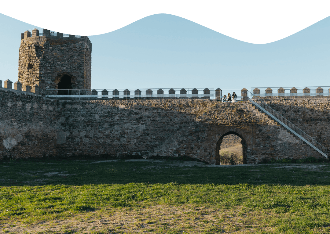
At the end of the slope there is another geosite, the Capas de Campoallá, marked with a milestone. All that remains is to go down to the village to begin the ascent to the castle of Alanís. To return to the starting point you just have to walk a little way back. Good Geo-Route.
The first and last kilometres in the village were the most beautiful.
The extension, which I thought was necessary due to the shortness of the route, only 7 km, was a bit heavy in the end, as it runs along two dirt tracks that are too flat and straight, which made the route monotonous.
Coming along the A-432 (from Cazalla), at the entrance to the village there are a series of streets named after Andalusian provinces; I park, making my homeland, on Calle Córdoba and from here I head for the adjacent Calle Manuel Díaz, where I leave the village, next to the football pitch. I start the climb towards the first milestone of the day, the Cerro del Cura; the path reaches a concrete section, where the slope becomes steeper, although it then becomes smoother, even flatter, before reaching the Cerro del Cura viewpoint. Unfortunately the fog prevents us from enjoying the view of the village (we have to make do with the panoramic photo on the panel); the path (from Guindales) descends again to the village, where we can see the traditional dry stone walls that delimit the olive groves or land for livestock.
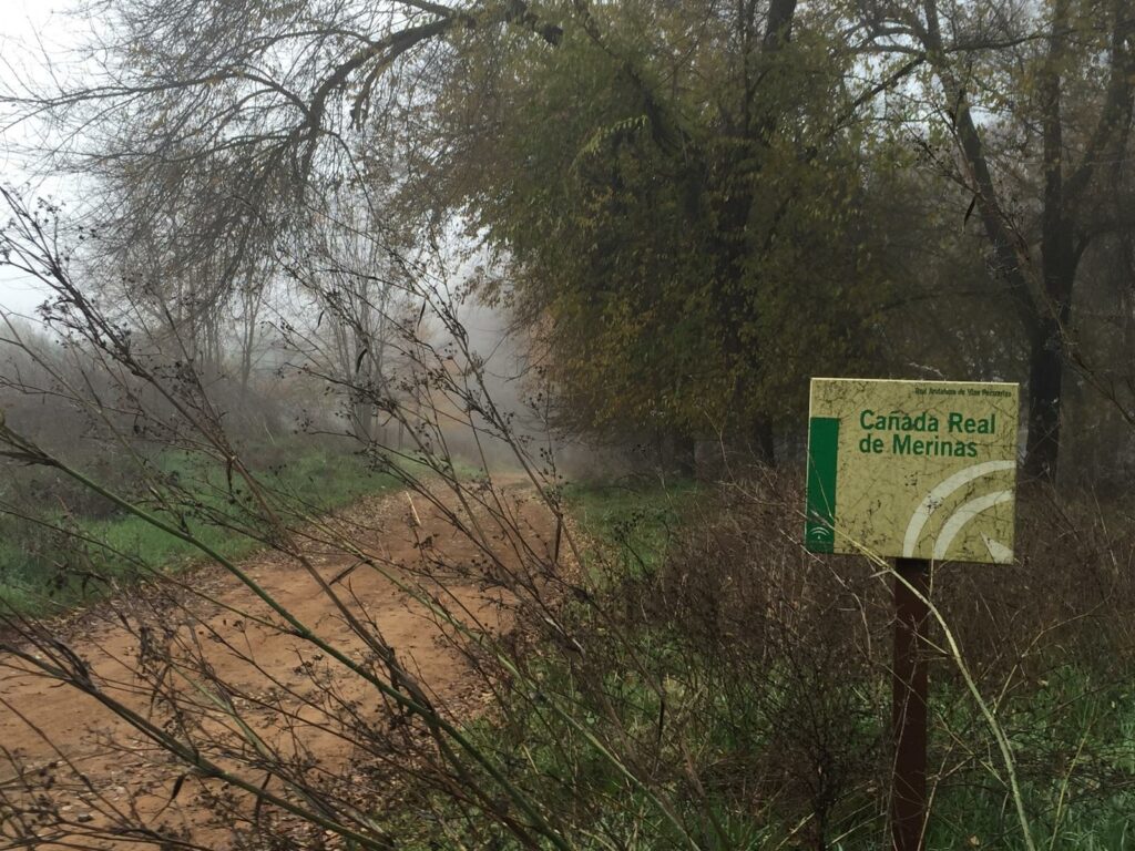
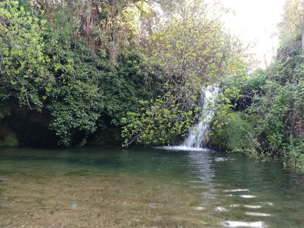
On reaching the road, continue to the right towards the roundabout and then along a road next to the A-433 (towards Guadalcanal), which still has some asphalted sections; after almost 2 kilometres along this road, leave it for another more interesting road on the left, the Cañada Real de Merinas (on which you can see a yellow arrow, as it is the route of a Jacobean pilgrimage route, the Camino de la Frontera, which continues towards Guadalcanal). The path, bordered by an elm grove, runs parallel to the Rivera de Benalija stream (although it is practically dry) and a short path takes us to the Cueva, a widening of the stream that descends a hillside with a small lake inside a cave.
Further on, the path forks; continuing along the path on the right, I then approach the stream of El Pueblo, before returning to the path that then links up with the one that goes off to the left and leads to the A-432. I continue to the right along this road for about 700 metres, and then along a path on the left (Camino Siete Caminos), which leads to the hermitage of the Virgen de las Angustias, patron saint of Alanís. It was erected to commemorate a victory over the “Moors” in the nearby valley of Matamoros. The first two sections date from the 15th century and the third, and the main chapel, from the 18th century. The main altarpiece, in Gothic style, has a sculptural group of the Pietà, with Saint John and the Magdalene, from the 16th century, which was destroyed, as was the original image of the Virgin of the Anguish, also Gothic, at the beginning of the Civil War.

A simple circular route through the area around Alanís.
The route passes through different areas of pastureland, which in the rainy season is very beautiful as it is extremely green. We pass several fences, but always along the signposted path. For this reason, one of the fences, the one marked as number 4, says at the entrance that it is forbidden to pass through, but these are old signs from after the signposting of the path by the Diputación (provincial council).
It is from fence number 5 (clockwise) that the path becomes more beautiful as it becomes a little wilder.
After leaving the path you climb up to the castle.
The route is simple, without difficulty. Above all, it is not technically difficult, as you walk on compacted terrain all the time. There are only a few climbs that can be overcome without much effort.
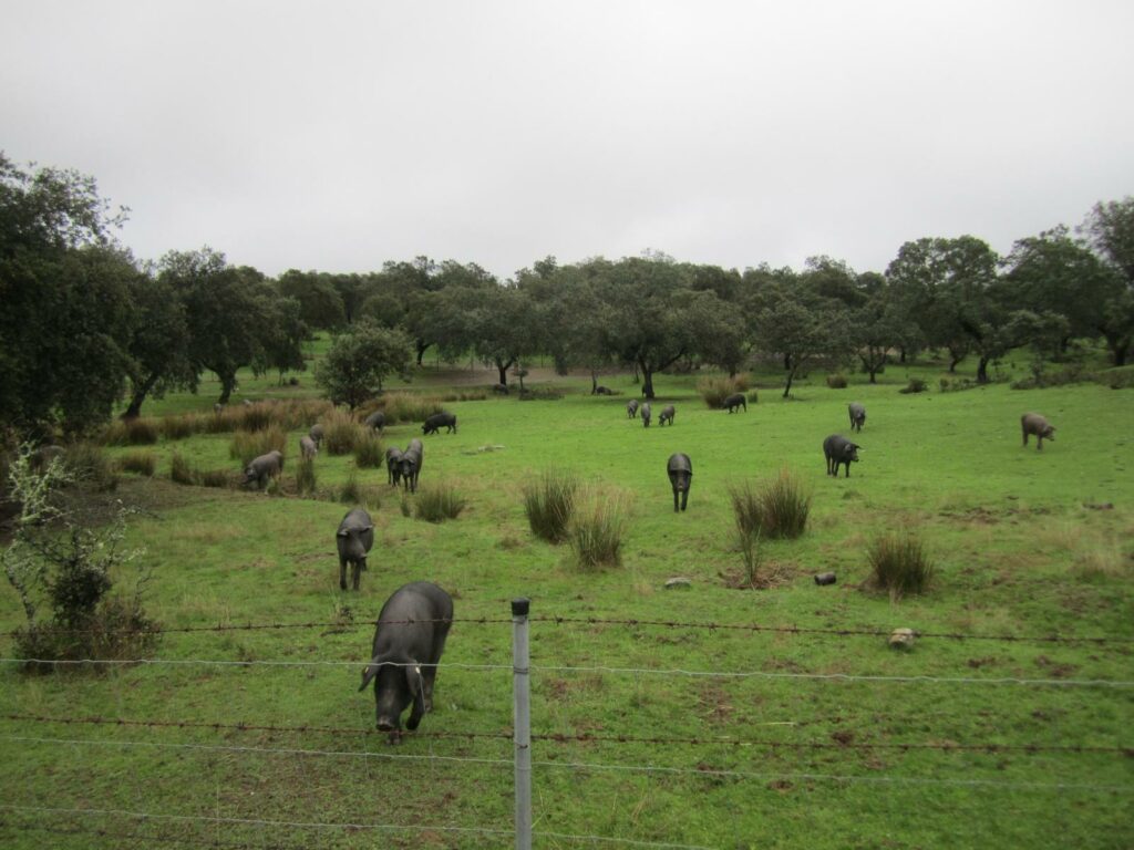
In the meadows, as usual, there are cattle. What we saw were sheep and pigs.
Border, Santiaguista Priory and the Pilgrim’s Way to Santiago de Compostela. The frontier of Granada or the Banda Morista and the Santiaguista Priory of San Marcos de León shaped and established the ancient Jacobean route of the Camino de la Frontera.
Since the late medieval period, the Sierra Sur in Seville has been defined as a natural frontier outlined by its own mountain range and a military border of bastions and fortified towers scattered throughout the southern mountain range.
The towns through which it passes are Alanís, Alcolea del Río, Algámitas, La Campana, Cazalla de la Sierra, Los Corrales, Écija, Estepa, Guadalcanal, Lora de Estepa, Lora del Río, Martín de la Jara, Pedrera, El Pedroso, Pruna, El Rubio, San Nicolás del Puerto, El Saucejo, Villanueva del Río y Minas, Villanueva de San Juan and Cañada Rosal.
It has a medium difficulty and is 262 km long.
Alanís 2022. Todos los derechos reservados © Nattule. Desarrollo web NattuAR.
We firmly believe that the internet should be available and accessible to anyone, and are committed to providing a website that is accessible to the widest possible audience, regardless of circumstance and ability.
To fulfill this, we aim to adhere as strictly as possible to the World Wide Web Consortium’s (W3C) Web Content Accessibility Guidelines 2.1 (WCAG 2.1) at the AA level. These guidelines explain how to make web content accessible to people with a wide array of disabilities. Complying with those guidelines helps us ensure that the website is accessible to all people: blind people, people with motor impairments, visual impairment, cognitive disabilities, and more.
This website utilizes various technologies that are meant to make it as accessible as possible at all times. We utilize an accessibility interface that allows persons with specific disabilities to adjust the website’s UI (user interface) and design it to their personal needs.
Additionally, the website utilizes an AI-based application that runs in the background and optimizes its accessibility level constantly. This application remediates the website’s HTML, adapts Its functionality and behavior for screen-readers used by the blind users, and for keyboard functions used by individuals with motor impairments.
If you’ve found a malfunction or have ideas for improvement, we’ll be happy to hear from you. You can reach out to the website’s operators by using the following email
Our website implements the ARIA attributes (Accessible Rich Internet Applications) technique, alongside various different behavioral changes, to ensure blind users visiting with screen-readers are able to read, comprehend, and enjoy the website’s functions. As soon as a user with a screen-reader enters your site, they immediately receive a prompt to enter the Screen-Reader Profile so they can browse and operate your site effectively. Here’s how our website covers some of the most important screen-reader requirements, alongside console screenshots of code examples:
Screen-reader optimization: we run a background process that learns the website’s components from top to bottom, to ensure ongoing compliance even when updating the website. In this process, we provide screen-readers with meaningful data using the ARIA set of attributes. For example, we provide accurate form labels; descriptions for actionable icons (social media icons, search icons, cart icons, etc.); validation guidance for form inputs; element roles such as buttons, menus, modal dialogues (popups), and others. Additionally, the background process scans all of the website’s images and provides an accurate and meaningful image-object-recognition-based description as an ALT (alternate text) tag for images that are not described. It will also extract texts that are embedded within the image, using an OCR (optical character recognition) technology. To turn on screen-reader adjustments at any time, users need only to press the Alt+1 keyboard combination. Screen-reader users also get automatic announcements to turn the Screen-reader mode on as soon as they enter the website.
These adjustments are compatible with all popular screen readers, including JAWS and NVDA.
Keyboard navigation optimization: The background process also adjusts the website’s HTML, and adds various behaviors using JavaScript code to make the website operable by the keyboard. This includes the ability to navigate the website using the Tab and Shift+Tab keys, operate dropdowns with the arrow keys, close them with Esc, trigger buttons and links using the Enter key, navigate between radio and checkbox elements using the arrow keys, and fill them in with the Spacebar or Enter key.Additionally, keyboard users will find quick-navigation and content-skip menus, available at any time by clicking Alt+1, or as the first elements of the site while navigating with the keyboard. The background process also handles triggered popups by moving the keyboard focus towards them as soon as they appear, and not allow the focus drift outside of it.
Users can also use shortcuts such as “M” (menus), “H” (headings), “F” (forms), “B” (buttons), and “G” (graphics) to jump to specific elements.
We aim to support the widest array of browsers and assistive technologies as possible, so our users can choose the best fitting tools for them, with as few limitations as possible. Therefore, we have worked very hard to be able to support all major systems that comprise over 95% of the user market share including Google Chrome, Mozilla Firefox, Apple Safari, Opera and Microsoft Edge, JAWS and NVDA (screen readers), both for Windows and for MAC users.
Despite our very best efforts to allow anybody to adjust the website to their needs, there may still be pages or sections that are not fully accessible, are in the process of becoming accessible, or are lacking an adequate technological solution to make them accessible. Still, we are continually improving our accessibility, adding, updating and improving its options and features, and developing and adopting new technologies. All this is meant to reach the optimal level of accessibility, following technological advancements. For any assistance, please reach out to